File:AhtubinskAirbaseMap1800x990g.jpg
Jump to navigation
Jump to search


Size of this preview: 800 × 440 pixels. Other resolutions: 320 × 176 pixels | 1,800 × 990 pixels.
Original file (1,800 × 990 pixels, file size: 604 KB, MIME type: image/jpeg)
Summary
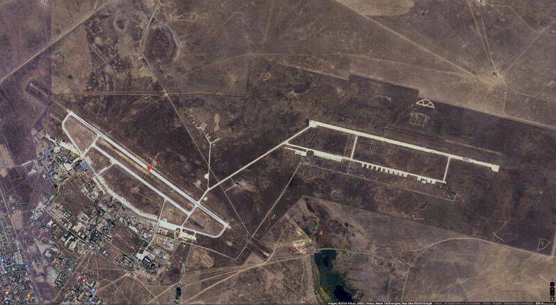
- ↑ https://www.google.com/maps/place/48°18'31.0%22N+46°12'15.0%22E/@48.3129138,46.2112695,6468m/data=!3m1!1e3!4m4!3m3!8m2!3d48.308611!4d46.204167?hl=en&entry=ttu 48°18'31.0"N 46°12'15.0"E 48.308611, 46.204167 Akhtubinsky District, Astrakhan Oblast, Russia 8653+CMV Akhtubi
Keywords
«Ahtubinsk Airbase», «Moscovia», «Авиабаза Ахтубинск», «[[]]», «Московия», «[[]]»,
File history
Click on a date/time to view the file as it appeared at that time.
| Date/Time | Thumbnail | Dimensions | User | Comment | |
|---|---|---|---|---|---|
| current | 17:31, 11 June 2024 |  | 1,800 × 990 (604 KB) | T (talk | contribs) | {{oq|AhtubinskAirbaseMap1800x990g.jpg|}} Ahtubinsk Airbase at the Google map <ref> https://www.google.com/maps/place/48°18'31.0%22N+46°12'15.0%22E/@48.3129138,46.2112695,6468m/data=!3m1!1e3!4m4!3m3!8m2!3d48.308611!4d46.204167?hl=en&entry=ttu 48... |
You cannot overwrite this file.
File usage
The following page uses this file: