File:C2011mar16c.jpg
Jump to navigation
Jump to search


Size of this preview: 488 × 599 pixels. Other resolutions: 195 × 240 pixels | 2,375 × 2,917 pixels.
Original file (2,375 × 2,917 pixels, file size: 405 KB, MIME type: image/jpeg)
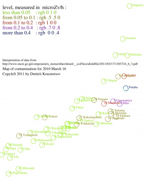
Map of contamination of Japan due to the Fukushima disaster for 2011 March 16, plotted by the data from
http://www.mext.go.jp/component/a_menu/other/detail/__icsFiles/afieldfile/2011/03/17/1303724_6_3.pdf
This is improved version of the file C2011mar16b.jpg (better resolution)
This image is generated with code c2011mar16.cc from data stored as c2011mar16.txt
Copyleft 2011 by Dmitrii Kouznetsov. Use for free, but indicate the source, it helps to trace the errors, if any.
File history
Click on a date/time to view the file as it appeared at that time.
| Date/Time | Thumbnail | Dimensions | User | Comment | |
|---|---|---|---|---|---|
| current | 17:50, 20 June 2013 |  | 2,375 × 2,917 (405 KB) | Maintenance script (talk | contribs) | Importing image file |
You cannot overwrite this file.
File usage
The following 3 pages use this file: