File:ChornobaivkaAirportMap.jpg
Jump to navigation
Jump to search

Size of this preview: 681 × 599 pixels. Other resolutions: 273 × 240 pixels | 1,093 × 962 pixels.
Original file (1,093 × 962 pixels, file size: 198 KB, MIME type: image/jpeg)
Summary
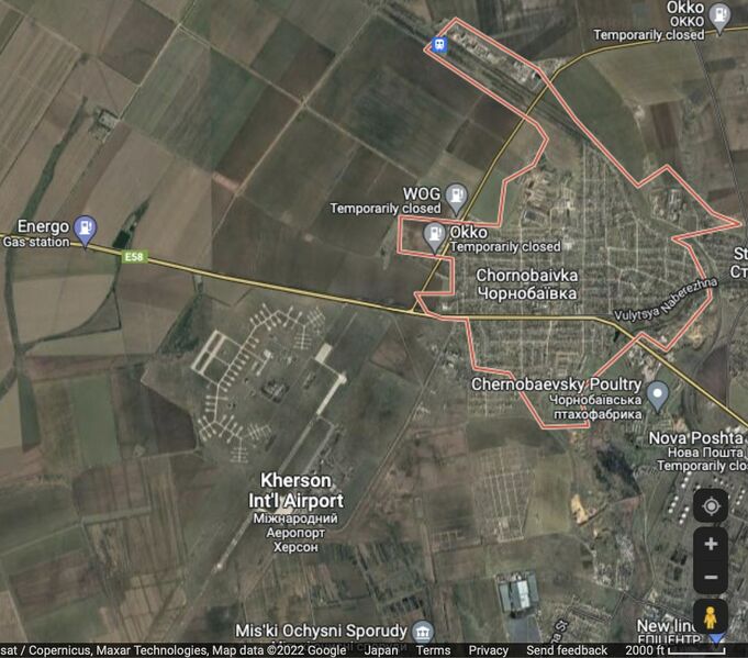
Chornobaivka (Чернобаевка) and the Kherson Airport at the Google map [1]
Coordinates: 46.6775,32.5079
References
File history
Click on a date/time to view the file as it appeared at that time.
| Date/Time | Thumbnail | Dimensions | User | Comment | |
|---|---|---|---|---|---|
| current | 09:37, 14 May 2022 | | 1,093 × 962 (198 KB) | T (talk | contribs) | <div style="margin:-18px -14px 0px -200px; background-color:#fff"> <div style="margin:0px 0px 0px 30px; line-height:1.2em"><br> Chornobaivka (Чернобаевка) and the Kherson Airport at the Google map <ref> https://www.google.com/map... |
You cannot overwrite this file.
File usage
The following page uses this file: