File:Dzerjinskogo3map.jpg
Jump to navigation
Jump to search

Size of this preview: 772 × 600 pixels. Other resolutions: 309 × 240 pixels | 1,362 × 1,058 pixels.
Original file (1,362 × 1,058 pixels, file size: 96 KB, MIME type: image/jpeg)
Summary
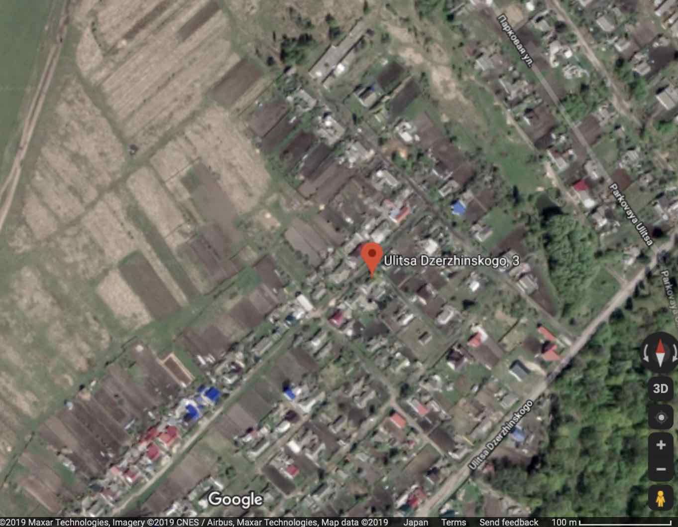
Брянская область, Брасовский район, поселок Локоть, улица Дзержинского, 3
Address: Ulitsa Dzerzhinskogo, 3 Lokot', Bryanskaya oblast', Russia, 242300
Coordinates: 52.56953, 34.56473
References
File history
Click on a date/time to view the file as it appeared at that time.
| Date/Time | Thumbnail | Dimensions | User | Comment | |
|---|---|---|---|---|---|
| current | 10:54, 1 September 2019 | | 1,362 × 1,058 (96 KB) | T (talk | contribs) | Брянская область, Брасовский район, поселок Локоть, улица Дзержинского, 3 Address: Ulitsa Dzerzhinskogo, 3 Lokot', Bryanskaya oblast', Russia, 242300 Coordinates: 52.56953, 34.56473 ==Refer... |
You cannot overwrite this file.
File usage
The following page uses this file: