File:KarafutoMapAnno.png
Jump to navigation
Jump to search


Size of this preview: 800 × 400 pixels. Other resolutions: 320 × 160 pixels | 1,856 × 928 pixels.
Original file (1,856 × 928 pixels, file size: 428 KB, MIME type: image/png)
Summary
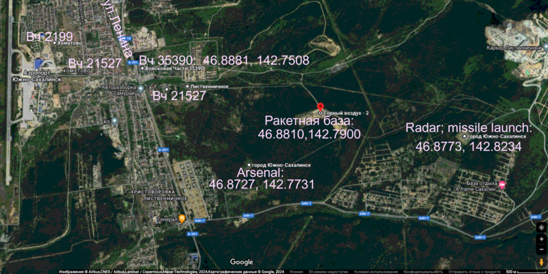
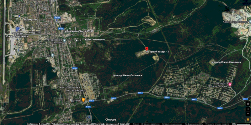
Попытка идентификации военных объектов, обнаруженных на карте
 от google
[1]
The annotation is performed with the following code:
convert KarafutoMap0.png -pointsize 44 -draw "gravity center fill #ffCCff \
text -760,-340 'Вч 2199' \
text -600,-250 'Вч 21527 ' \
text -360,-260 'Вч 35390:' \
text -60,-260 '46.8881, 142.7508' \
text -320,-140 'Вч 21527' \
text  120,-56 'Ракетная база:'\
text  120,-10 '46.8810,142.7900'\
text  660,-32 'Radar; missile launch:'\
text  660,32 '46.8773, 142.8234'\
text -40,120 'Arsenal: '\
text -40,160 '46.8727, 142.7731'\
rotate 67 \
text -550,340 ' ул.Ленина' \
" \
png8:04.png;
Rescription
RF has performed an illegal operation and will be shut down.
References
- ↑ https://www.google.com/maps/dir/Войсковая+Часть+35390,+ул.+Армейская,+д.20,+Южно-Сахалинск,+Сахалинская+обл.,+Россия,+693014/Горный+воздух+-+2,+VQJQ%2B9W,+Южно-Сахалинск,+Сахалинская+обл.,+Россия,+693004/@46.8848285,142.748657,4070m/data=!3m2!1e3!4b1!4m14!4m13!1m5!1m1!1s0x5f19a9347ea17d17:0xc3718c4eba208f39!2m2!1d142.748382!2d46.8880687!1m5!1m1!1s0x5f19af8cb582ddef:0xddb098684575c00f!2m2!1d142.7898125!2d46.8809375!3e2?hl=ru&entry=ttu
Keywords
«А нас то за что», «Вч 2199», «[[]]», «Вч 21527», «Вч 35390», «[[]]», «[[]]», «Горный воздух - 2», «Иванов Иван Иванович», «Легитимная цель», «Ленин Владимир Ильич», «Паханат», «Путинская мировая война», «Российское вторжение в Украину», «Спецоперция», «Террор», «Я бомбил Дрезден», «Японие»,
File history
Click on a date/time to view the file as it appeared at that time.
| Date/Time | Thumbnail | Dimensions | User | Comment | |
|---|---|---|---|---|---|
| current | 21:05, 30 April 2024 |  | 1,856 × 928 (428 KB) | T (talk | contribs) | == Summary == {{oq|KarafutoMapAnno.png|}} Попытка идентификации военных объектов, обнаруженных на карте {{pic|KarafutoMap08.png|800px}} от google <ref> https://www.google.com/maps/dir/Войск... |
You cannot overwrite this file.
File usage
The following page uses this file: