File:OlhivkaOrskMap.jpg
Jump to navigation
Jump to search


Size of this preview: 800 × 476 pixels. Other resolutions: 320 × 190 pixels | 840 × 500 pixels.
Original file (840 × 500 pixels, file size: 104 KB, MIME type: image/jpeg)
Summary
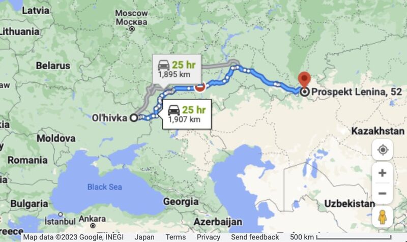
Орский военкомат, вербующий орков (красная метка) и город Олгивка (слева); туда некоторые из завербованных орков посылаются, чтобы грабить и убивать жителей Украины.
Map by Google [1]
Refefences
- ↑ https://www.google.com/maps/dir/Ol'hivka,+Kharkiv+Oblast,+Ukraine,+63841/Prospekt+Lenina,+52,+Orsk,+Orenburgskaya+oblast',+Russia,+462404/@59.7889925,1.2368886,4z/data=!4m13!4m12!1m5!1m1!1s0x41208bd14bc0a897:0x846391f4f8df4e54!2m2!1d37.8509457!2d49.2447189!1m5!1m1!1s0x417ffa45408ef1f1:0xad8266104c96d2fc!2m2!1d58.4711674!2d51.2381517
File history
Click on a date/time to view the file as it appeared at that time.
| Date/Time | Thumbnail | Dimensions | User | Comment | |
|---|---|---|---|---|---|
| current | 16:15, 27 January 2023 |  | 840 × 500 (104 KB) | T (talk | contribs) | <div style="margin:-18px -14px 0px -200px; background-color:#fff"> <div style="margin:0px 0px 0px 30px; line-height:1.2em"><br> Орский военкомат, вербующий орков (красная метка) и город Олгив... |
You cannot overwrite this file.
File usage
The following page uses this file: