File:Si-radiation-thumb-200xauto-6005b.jpg
Jump to navigation
Jump to search
Size of this preview: 800 × 527 pixels. Other resolutions: 320 × 211 pixels | 1,520 × 1,002 pixels.
Original file (1,520 × 1,002 pixels, file size: 71 KB, MIME type: image/jpeg)
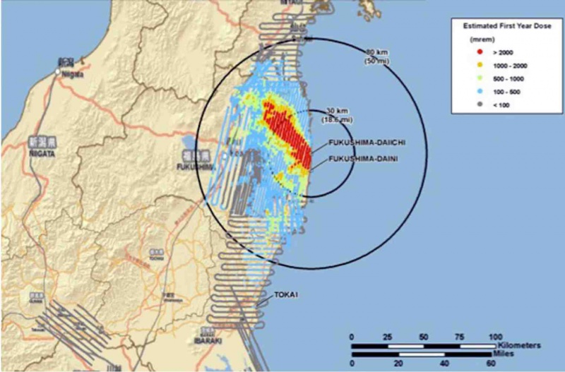
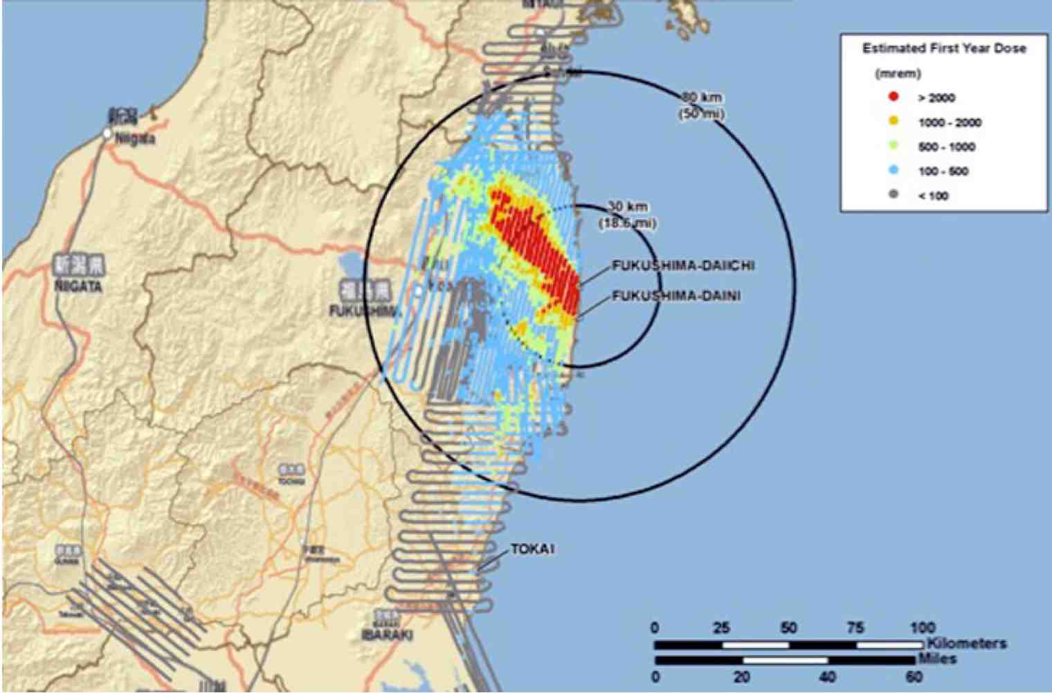
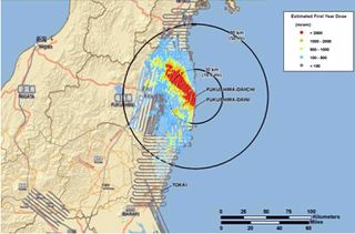
Cumulative Aerial map of contamination after the Fukushima disaster for 2011 March 21 - April 21 by data of A new map from the U.S. Department of Energy (DOE) posted by Jocelyn Kaiser [1]
- ↑ http://news.sciencemag.org/scienceinsider/2011/04/a-map-of-fukushimas-radiation.html?ref=hp Jocelyn Kaiser. A Map of Fukushima's Radiation Risks. 22 April 2011, 11:17 AM.
File history
Click on a date/time to view the file as it appeared at that time.
| Date/Time | Thumbnail | Dimensions | User | Comment | |
|---|---|---|---|---|---|
| current | 17:50, 20 June 2013 | | 1,520 × 1,002 (71 KB) | Maintenance script (talk | contribs) | Importing image file |
You cannot overwrite this file.
File usage
The following 7 pages use this file: