File:UkrainkaAirbaseMap18.png
Original file (1,600 × 800 pixels, file size: 208 KB, MIME type: image/png)
Summary
Keywords
«Annexation of Crimea», «Budapest memorandum», «Buffer Zone», «Demilitarization and denazification», «Designate Russia as state sponsor of terrorism», «Designate Russia as terrorist state», «Fascism», «Moscovia», «Pahanat», «Putin world war», «Russian invasion into Ukraine», «Russki mir», «Target», «Transfer of hostiilties to aggressor territory», «UkrainkaAirbase», «UkrainkaArsenal»,
«А нас то за что», «Авиабаза Украинка», «Арсенал Украинка», «Вч 75715», «Демилитаризация и денацификация», «Зеленый Клин», «Московия», «Нюрнберг-2», «Перенос боевых действий на территорию страны агрессора», «[[]]», «Русский мир», «Российское вторжение в Украину», «Серышево», «Спецоперация», «Ст.110 УК Украины», «Ст.353 УК РФ», «Фашизм»,
File history
Click on a date/time to view the file as it appeared at that time.
| Date/Time | Thumbnail | Dimensions | User | Comment | |
|---|---|---|---|---|---|
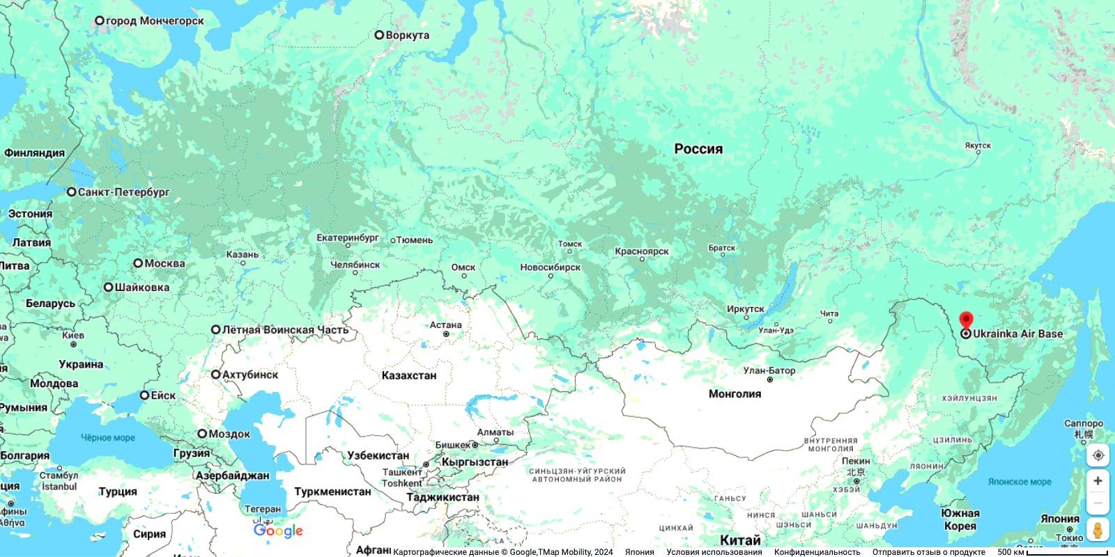
| current | 15:20, 28 February 2025 | | 1,600 × 800 (208 KB) | T (talk | contribs) | {{oq|UkrainkaAirbaseMap18.png|}} Авиабаза Украинка (UkrainkaAirbaze) на гуглевской карте Московии <ref> https://www.google.co.jp/maps/place/Украинка,+Амурская+обл.,+Россия,+676366/@51.154,128.48,12188m/data=!3m1!1e3!4m6!3m5!1s0x5e8e5a593ae6c89f:0xa9f5c78fcd126b0e!8m2!3d51.1445363!4d128.5099476!16s%2Fg%2F12mb3vx_9?hl=ru&entry=ttu&g_ep=EgoyMDI1MDIyNC4wIKXMDSoASAFQAw%3D%3D </ref> ==References== {{ref}} {{fer}} ==Keywords== «Annexation of Crimea», «Budapest memorandum», «[[Buff... |
You cannot overwrite this file.
File usage
The following page uses this file: