File:UkrainkaAirnaseMap11.jpg
Original file (1,846 × 1,634 pixels, file size: 623 KB, MIME type: image/jpeg)
Summary
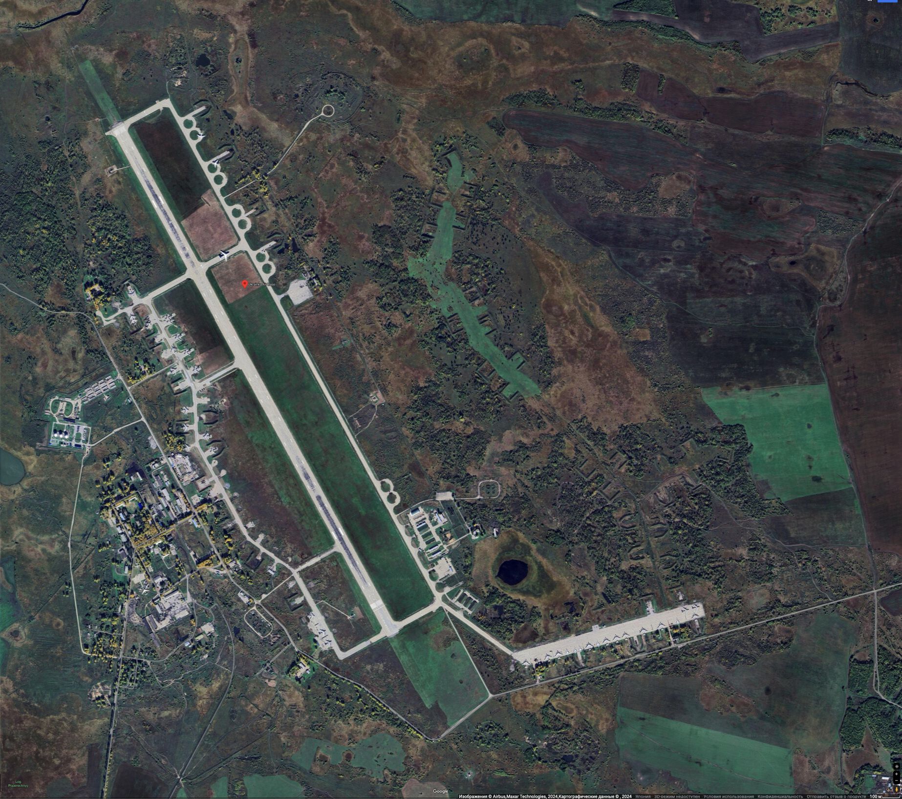
- ↑ https://www.google.co.jp/maps/place/Ukrainka+Air+Base/@51.17503,128.4405001,663m/data=!3m2!1e3!4b1!4m6!3m5!1s0x5e8e50f44b3f57ab:0x971adce607e22bcc!8m2!3d51.17503!4d128.4430804!16s%2Fg%2F11f_3x0w8r?hl=ru&entry=ttu Ukrainka Air Base Амурская обл., Россия, 676366 5CGV+26 Украинка, Амурская обл., Россия (2024)
Keywords
«Annexation of Crimea», «[[]]», «Budapest memorandum», «Demilitarization and denazification», «Legitimate military target», «Moscovia», «Pahanat», «Putin world war», «Russian invasion into Ukraine», «Transfer of hostilities to aggressor territory», «UkrainkaAirbase», «Vh75715»,
«А нас то за что», «Авиабаза Украинка», «Вч 75715», «Демилитаризация и денацификация», «Московия», «Нюрнберг-2», «Перенос боевых действий на территорию страны агрессора», «Спецоперация», «[[]]», «Русский мир», «Российское вторжение в Украину», «Серышево», «Ст.110 УК Украины», «Ст.353 УК РФ», «Тимур и его банда», «Фашизм»,
File history
Click on a date/time to view the file as it appeared at that time.
| Date/Time | Thumbnail | Dimensions | User | Comment | |
|---|---|---|---|---|---|
| current | 15:46, 28 February 2025 | | 1,846 × 1,634 (623 KB) | T (talk | contribs) | {{oq|UkrainkaAirnaseMap11.jpg|}} UkrainkaAirbase (Авиабаза Украинка) на гуглевской карте <ref> https://www.google.co.jp/maps/place/Ukrainka+Air+Base/@51.17503,128.4405001,663m/data=!3m2!1e3!4b1!4m6!3m5!1s0x5e8e50f44b3f57ab:0x971adce607e22bcc!8m2!3d51.17503!4d128.4430804!16s%2Fg%2F11f_3x0w8r?hl=ru&entry=ttu Ukrainka Air Base Амурская обл., Россия, 676366 5CGV+26 Украинка, Амурская обл., Россия (2024) </ref> ==References== {{ref}} {{fer}} ==Keywords== «Annexation of Crimea», «[[... |
You cannot overwrite this file.
File usage
The following page uses this file: