File:Vh63779map1.jpg
Jump to navigation
Jump to search


Size of this preview: 800 × 381 pixels. Other resolutions: 320 × 152 pixels | 1,481 × 705 pixels.
Original file (1,481 × 705 pixels, file size: 328 KB, MIME type: image/jpeg)
Summary
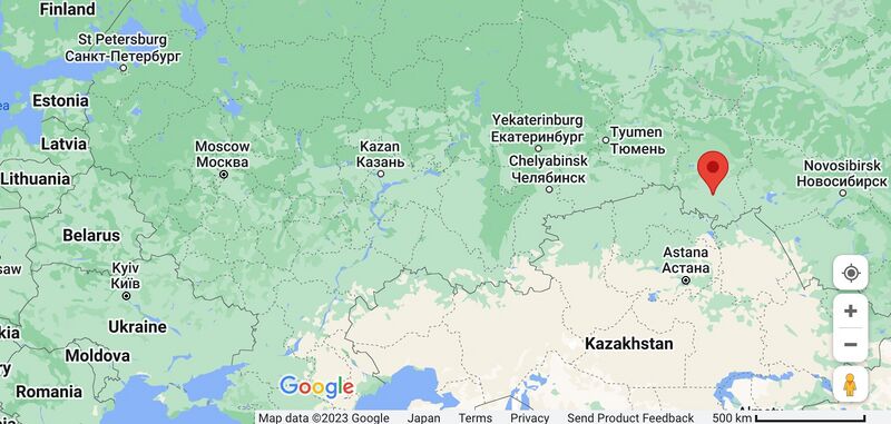
Address: Tsentral'nyy Okrug, Omsk, Omsk Oblast, Russia
Coordinates: 55.015200, 73.397400
References
- ↑ https://www.google.com/maps/place/55%C2%B000'54.7%22N+73%C2%B023'50.6%22E/@54.9934486,73.1596463,11z/data=!4m4!3m3!8m2!3d55.0152!4d73.3974?entry=ttu Tsentral'nyy Okrug, Omsk, Omsk Oblast, Russia 55.015200, 73.397400
Keywords
«Annexation of Crimea», «Designate Russia as state sponsor of terrorism», «Designate Russia as terrorist state», «Vh63779»,
«А нас то за что», «Бавовна», «Вч 63779», «Нацизм», «[[]]», «Перенос боевых действий на территорию страны агрессора», «Путинская мировая война», «Рашизм», «Спецоперация», «Фашизм»,,
File history
Click on a date/time to view the file as it appeared at that time.
| Date/Time | Thumbnail | Dimensions | User | Comment | |
|---|---|---|---|---|---|
| current | 10:03, 3 September 2023 |  | 1,481 × 705 (328 KB) | T (talk | contribs) | == Summary == <div style="margin:-18px -14px 0px -200px; background-color:#fff"> <div style="margin:0px 0px 0px 30px; line-height:1.2em"><br> Vh63779 at the Google map<ref><small> https://www.google.com/maps/place/55%C2%B000'54.7%22N+73%C2%B023'5... |
You cannot overwrite this file.
File usage
The following page uses this file: