File:RussiaUkraine2014.07.21.map.png
Revision as of 08:50, 1 December 2018 by Maintenance script (talk | contribs)
Size of this preview: 721 × 600 pixels. Other resolutions: 289 × 240 pixels | 950 × 790 pixels.
Original file (950 × 790 pixels, file size: 764 KB, MIME type: image/png)
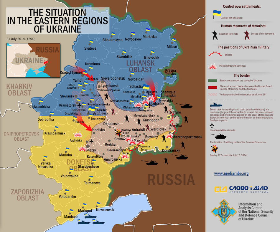
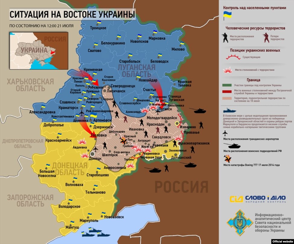
Map of the front line of the Russian–Ukrainian war for the 2014.07.21 by [1][2]
Original:
http://ic.pics.livejournal.com/avmalgin/6046593/1201976/1201976_original.png
http://gdb.rferl.org/E73CD6F7-CAD5-4AE6-9982-BF281B1A1234_w974_n_s_s.jpg
The honest use is assumed, the source should be attributed.
References
- ↑ http://ru.krymr.com/media/photogallery/25456740.html 22 июля 2014, Киев 06:18. Ситуация в зоне АТО (хронология). Опубликовано 14.07.2014 Развитие ситуации в зоне АТО начиная с 14 июля. Инфографика Информационно-аналитического центра Совета национальной безопасности и обороны Украины.
- ↑ http://avmalgin.livejournal.com/4734524.html Июль 22, 2014, 12:40 am - Карта боевых действий Вот так сейчас выглядят Луганская и Донецкие области Украины. Территория, контролируемая террористами, сжимается день ото дня (в центре обратите внимание - место падения "Боинга"). С юга террористов от российской границы удалось отсечь, с востока, как видим, пока нет. Как только закроют, дело у украинцев пойдет быстрее.
File history
Click on a date/time to view the file as it appeared at that time.
| Date/Time | Thumbnail | Dimensions | User | Comment | |
|---|---|---|---|---|---|
| current | 06:14, 1 December 2018 | | 950 × 790 (764 KB) | Maintenance script (talk | contribs) | Importing image file |
You cannot overwrite this file.
File usage
There are no pages that use this file.