File:MapBuk.jpg
Revision as of 08:42, 1 December 2018 by Maintenance script (talk | contribs)
Size of this preview: 800 × 470 pixels. Other resolutions: 320 × 188 pixels | 1,562 × 917 pixels.
Original file (1,562 × 917 pixels, file size: 363 KB, MIME type: image/jpeg)
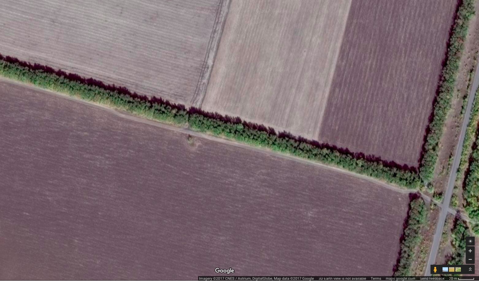
Google map at 47.97399, 38.76416
References
https://www.facebook.com/groups/pobedim/permalink/1056737647792627/
Sergej Repin. 2017.03.03.
Точные географические координаты места пуска зенитной ракеты ЗРК "Бук-М", уничтожившей малазийский Боинг-777, выполнявший рейс МН17 по маршруту Амстердам - Куала-Лумпур 17 июля 2014 года:
47°58’26.10” северной широты, 38°45’50.02” восточной долготы.
File history
Click on a date/time to view the file as it appeared at that time.
| Date/Time | Thumbnail | Dimensions | User | Comment | |
|---|---|---|---|---|---|
| current | 06:13, 1 December 2018 | | 1,562 × 917 (363 KB) | Maintenance script (talk | contribs) | Importing image file |
You cannot overwrite this file.