File:UFSBsaraMap.jpg
Jump to navigation
Jump to search
Size of this preview: 756 × 600 pixels. Other resolutions: 303 × 240 pixels | 1,221 × 969 pixels.
Original file (1,221 × 969 pixels, file size: 343 KB, MIME type: image/jpeg)
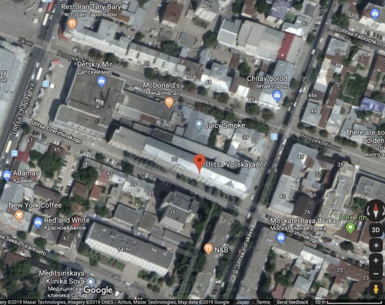
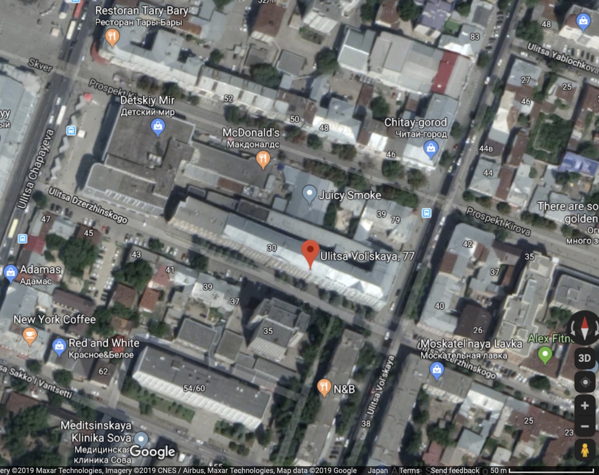
Place: Frunzenskiy Rayon Saratov, Saratov Oblast, Russia
Coordinates: 51.53182, 46.02371
References
https://www.google.com/maps/place/Ulitsa+Vol'skaya,+77,+Saratov,+Saratovskaya+oblast',+Russia,+410029/@51.5322064,46.0219079,334m/data=!3m1!1e3!4m5!3m4!1s0x4114c7b8da9db4bb:0xe2e32e1a842f6d97!8m2!3d51.5318!4d46.023264
Cagegory:Dzerjinski Feliks Edmundovich
Caetgory:Frunze Mihail Vasilievich
File history
Click on a date/time to view the file as it appeared at that time.
| Date/Time | Thumbnail | Dimensions | User | Comment | |
|---|---|---|---|---|---|
| current | 15:55, 23 September 2019 | | 1,221 × 969 (343 KB) | T (talk | contribs) |
You cannot overwrite this file.
File usage
There are no pages that use this file.