File:Vh74777map01.jpg
Revision as of 12:39, 19 November 2022 by T (talk | contribs) (== Summary == Vh74777 (Вч 74777) at the Google map <ref> https://www.google.com/maps/place/75°46'00.0%22N+137°44'30.0%22E/@69.1004482,9.0431273,3z/data=!4m5!3m4!1s0x0:0xfaa312097b4da006!8m2!3d75.76667!4d137.74167?hl=ru <ref>. Address: Б...)

Size of this preview: 800 × 405 pixels. Other resolutions: 320 × 162 pixels | 1,334 × 675 pixels.
Original file (1,334 × 675 pixels, file size: 100 KB, MIME type: image/jpeg)
Summary
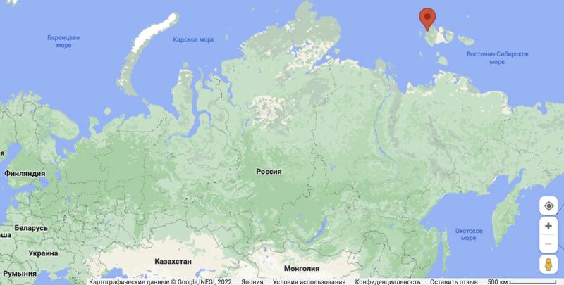
Vh74777 (Вч 74777) at the Google map <ref> https://www.google.com/maps/place/75°46'00.0%22N+137°44'30.0%22E/@69.1004482,9.0431273,3z/data=!4m5!3m4!1s0x0:0xfaa312097b4da006!8m2!3d75.76667!4d137.74167?hl=ru <ref>.
Address:
Булунский у., остров Котельный, Респ. Саха (Якутия), Россия
Coordinates: 75.7666,137.7416
References
File history
Click on a date/time to view the file as it appeared at that time.
| Date/Time | Thumbnail | Dimensions | User | Comment | |
|---|---|---|---|---|---|
| current | 12:39, 19 November 2022 |  | 1,334 × 675 (100 KB) | T (talk | contribs) | == Summary == Vh74777 (Вч 74777) at the Google map <ref> https://www.google.com/maps/place/75°46'00.0%22N+137°44'30.0%22E/@69.1004482,9.0431273,3z/data=!4m5!3m4!1s0x0:0xfaa312097b4da006!8m2!3d75.76667!4d137.74167?hl=ru <ref>. Address: Б... |
You cannot overwrite this file.
File usage
The following page uses this file: